In this way, maps can serve as historical sources that tell us much more about the past and present than common geographical information. On this page, you will find maps new and old that may be of interest for Ottoman historians. We have selected these maps on the basis of their being interesting and of high image quality, not for any innate importance or precision.
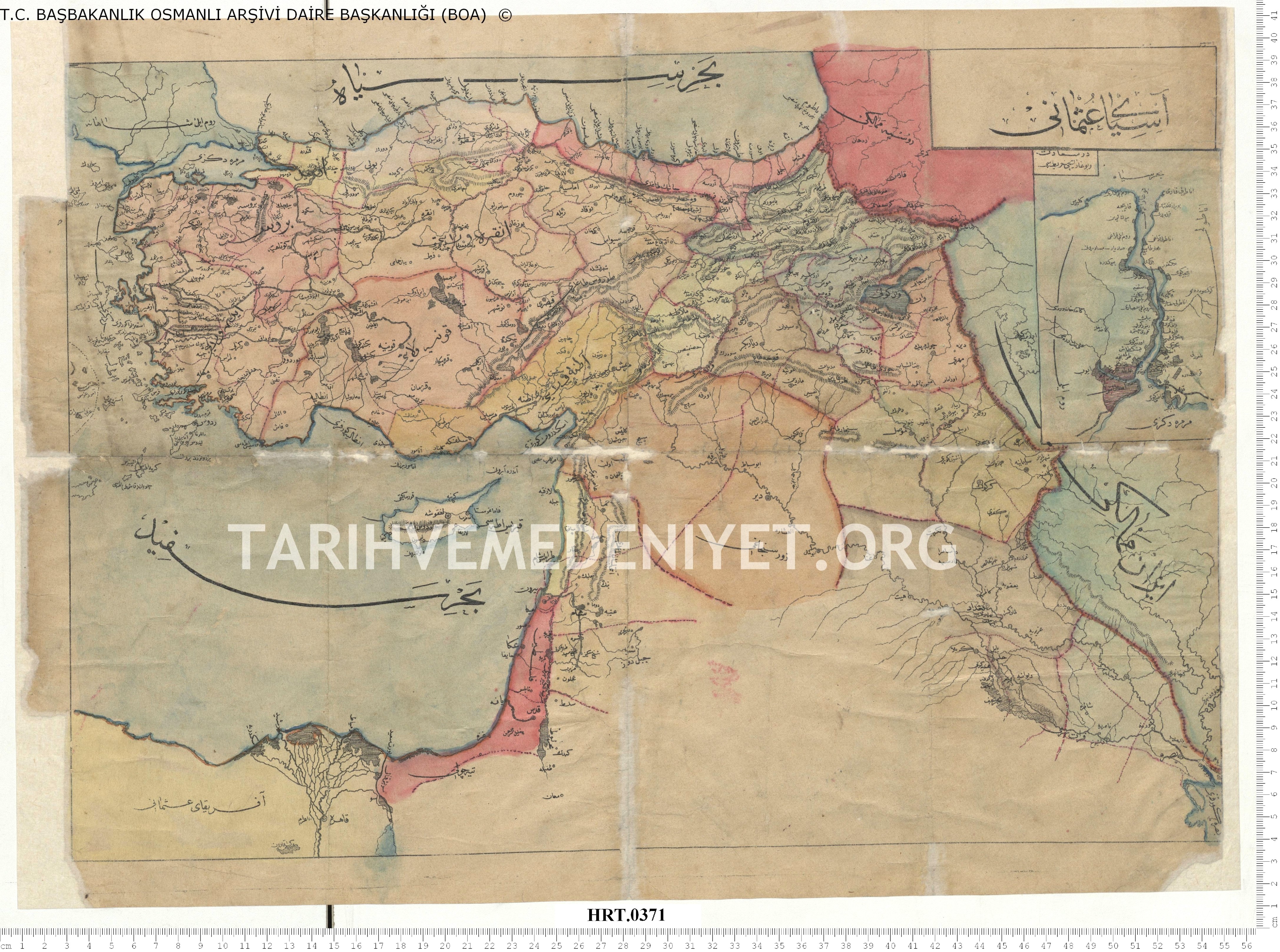
This is a map of the Ottoman Empire's Anatolian and Syrian provinces from the late-nineteenth century. The Başbakanlık Ottoman Archives contain many such maps. This one has been shared on tarihvemedeniyet.org.
PIRI REIS MAP OF MEDITERRANEAN AND NEW WORLD (Ottoman, 16th Century)
Piri Reis was an Ottoman admiral and cartographer. His 1517 work entitled Kitab-ı Bahriye, which contains many detailed maps, included a map of the coast of the New World based on apparently fast-spreading news of the recent European discoveries.
This copy of his map of the Mediterranean region from the 16th century reflects a startlingly accurate scale and detail for the period.

THE BOSPHORUS AND GOLDEN HORN, CONSTANTINOPLE (Ottoman, 17th Century)
This is a map of Istanbul's waterways and the adjacent settlements as of the 17th century, taken from Katib Çelebi's extensive Cihannüma.

SEUTTER MAP OF OTTOMAN EMPIRE (German, 18th Century)
Georg Matthäus Seutter (1647-1756) was a highly successful German map publisher. This map of the Ottoman Empire from 1730 contains many notable inaccuracies regarding the geography of Anatolia, the Caspian and Dead Seas, and general problems of scale.
There are also quite a few curious labels and placements. For example, if we look at modern-day Armenia, Mt. Ararat is in a completely incorrect location East of Yerevan, and there is a giant island in the middle of Lake Sevan. There are numerous such examples throughout the map. Interesting regions such as Azerbaijan, Kurdistan and "Turcomania" also stand out, and while one would expect Eastern Anatolia and the Caucasus to be somewhat uncharted territory for Europeans, even a relatively central location such as Izmit is quite misplaced and the Mediterranean Sea is simply too small.
Nonetheless it is a fairly detailed and accurate map for its period, and in many was the Seutter map is an interesting reminder of the extent to which the Ottoman Empire was terra incognita even for geographers in Europe at the time.
,_Persia_and_Arabia_-_Geographicus_-_MagniTurcarum-seutter-1740.jpg)
MÜTEFERRİKA MAP OF PERSIA AND EASTERN ANATOLIA (Ottoman, 18th Century)
This map produced by Müteferrika may reflect the influence of his travels as an Ottoman diplomat. It is based in part on a map produced by Homann in 1724 and can be compared with the Seutter map above.

CRIMEA (French, 1867)
This is a map of the Crimea region of modern-day Ukraine. This region was part of the Ottoman Empire, though by the eighteenth century mostly autonomous, and came under Russian influence with the Treaty of Küçük Kaynarca in 1774. Crimea was the main region of dispute during the Crimean War (1853-1856), which pitted the Russians against the Ottomans and their allies in Britain, France, and the Kingdom of Sardinia. It is often referred to as the first "modern war" because of the emergence of certain technologies and institutions associated with modern warfare as well as the global aspect of the conflict.
During and following the Crimean War, many Muslim Tatars left or were forced out of the region and settled in the Ottoman Empire. There would be periods of such migration throughout history, including during World War II, when the Soviet government forcibly deported hundreds of thousands of Tatars to Central Asia in what is remembered as "the Exile (Sürgün).
